Destination briefing
Why travelers stop here
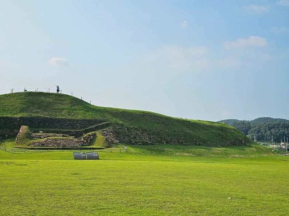
Horogoru is located at an important crossroads connecting Gaeseong and Seoul, built on a basalt cliff formed by a tributary flowing into the Imjin River from Wondang-ri. Regarding the origin of the name Horogoru, there is a theory that it is called Horogoru because the topography of the area resembles a gourd or calabash, and another theory that it combines 'hol' meaning village and 'guru' meaning fortress. It is one of the three major plain fortresses among the Goguryeo defense sites surveyed in Gyeonggi Province, along with Dangposeong and Eundaeriseong.
The eastern wall of Horogoru was built by blocking the eastern part of the basalt plateau, with the highest section reaching 10m, offering views of the surrounding area and the scenic Imjin River from the top of the wall. The first excavation survey of Horogoru was conducted from November 2000 to May 2002, confirming the construction method and structure of the walls. The total circumference of the Horogoru walls is 401m, with the southern wall at 161.9m, the northern wall at 146m, and the eastern wall at 93.1m, covering an internal area of 606㎡, situated on a basalt cliff about 28m high. The eastern wall was built by piling up earth in layers multiple times and then raising the wall with stones, demonstrating a construction technique that appropriately combines the advantages of both stone and earthen fortifications.
OTA-ready stop
Built into inbound routes and day-tour planning.
Local context
경기도 연천군 장남면 원당리
Travel fit
Attraction · Gyeonggi-do



![[Early bird] Elysian Gangchon Ski & Snowboard Gugok Ice Wall Tour](/_next/image?url=https%3A%2F%2Fadmin.holidaykr.com%2Fapi%2Fadmin%2Fsystem%2Fbasic-settings%2Ffavicon%3Fpath%3D%252Fuploads%252Fproducts%252Fthumbs%252F750_1791455110103_file1.jpg&w=3840&q=75)