Destination briefing
Why travelers stop here
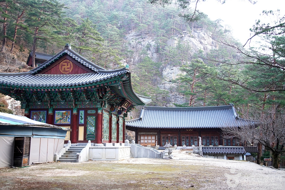
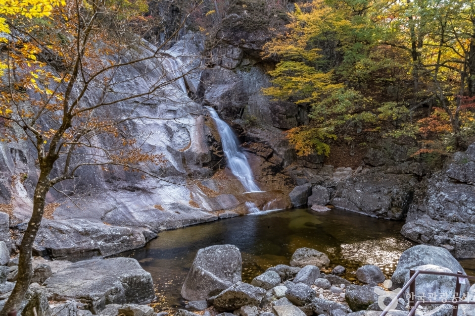
Myeongju Cheonghak-dong Sogeumgang is a scenic site located in Yeongok-myeon, Gangneung-si, Gangwon-do. It was designated as Scenic Site No. 1 on November 23, 1970. The area is approximately 22㎢ and is part of Odaesan National Park, accounting for one-quarter of the park's total area. The first scenery upon entering Sogeumgang is Mureunggye (武陵溪), which is about 300m long, where a valley of rapids and clear pools (靑潭) unfolds. In 1569, Yulgok (栗谷) Yi I explored Cheonghaksan (靑鶴山) and left a writing titled 『Yucheonghaksangi (遊靑鶴山記)』, which began to make this place known to the world. Yulgok Yi I named the mountain, then called Cheonghaksan (靑鶴山), as Sogeumgang. In 2021, the Odaesan National Park Office and the Yulgok Research Institute, through literature review and field surveys, refurbished a section of the Sogeumgang trail (round trip 6.2㎞ from Sogeumgang parking lot to Guryong Falls) and named it '1569 Yulgok Yusan-gil', promoting it as a notable site. It is said that the three characters '小金剛' carved on a large rock in the valley in front of Geumgangsa (金剛寺) are Yulgok's handwriting, but this has not been confirmed. However, the nickname 'Sogeumgang' was given because the mountain's topography and rocks and waters seem to be a miniature version of those of Mt. Geumgang. Not only does it boast magnificent scenery reminiscent of Mt. Geumgang, but it is also rich in historical heritage. The streams here are narrow as if the two cliffs touch, and the water is clear and transparent. Mureunggye is located low enough not to be noticeable from the hiking trail, and Sipjaso (十字沼) is a deep rock waterway where both sides and the bottom are connected by a single stone. Such waterways are rare in valleys and offer a different charm from waterfalls or shallows.
OTA-ready stop
Built into inbound routes and day-tour planning.
Local context
강원특별자치도 강릉시 연곡면 소금강길 449
Travel fit
Attraction · Gangwon-do
![[Early bird] Elysian Gangchon Ski & Snowboard Gugok Ice Wall Tour](/_next/image?url=https%3A%2F%2Fadmin.holidaykr.com%2Fapi%2Fadmin%2Fsystem%2Fbasic-settings%2Ffavicon%3Fpath%3D%252Fuploads%252Fproducts%252Fthumbs%252F750_1791455110103_file1.jpg&w=3840&q=75)